Nottingham Canal
Main menu
Part 3
Balloon Woods to the Trent
If a new bridge was constructed at Coventry Lane, the next objective would have to be to reconnect the canal to Nottingham. A mile further on, the canal descended a magnificent flight of broad stone locks -

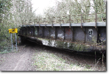
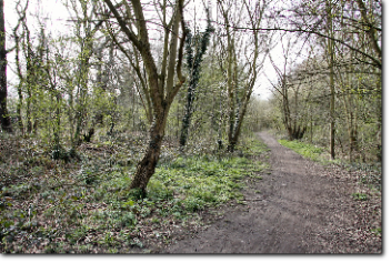
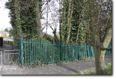
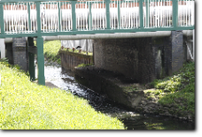
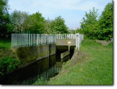
From Coventry lane, a very short section in water passes under a bridge carrying a main passenger railway line from Nottingham. This is lucky -
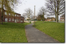
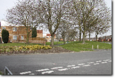
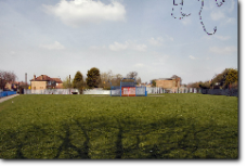
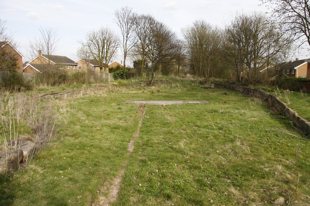
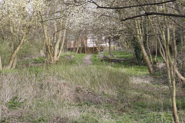
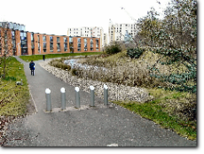
A little further on, abruptly, the canal route emerges into a housing estate. The former route can clearly be seen as a modern landscaped path in what appears to be a canal bed. It isn’t the original bed -
For the next 1/2 mile, it wouldn’t so much be restoration as reconstruction as several gardens, a school playing field and some difficult road crossings would need to be made. It is all theoretically possible; and the canal could then lock down along the edge of some allotments to the next visible lock remains at Lambourne Drive. However, a radical solution might be considered at this point, that could be rather cheaper and far less disruptive to all concerned. This would be to build new locks, where the new pathway is, to descend to a level where quite a short new tunnel would enable the canal to emerge in the allotments and continue to Lambourne Drive as before. Obviously costings would show the optimum point to disappear underground, for example it might be better to continue through several gardens and the school playing field before descending. However, any engineer will tell you it is much cheaper to build a new tunnel than restore an old one!
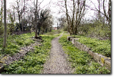
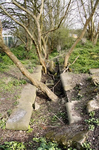
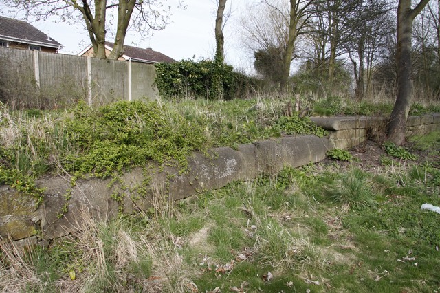
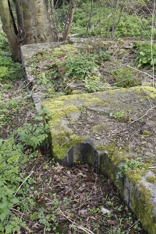
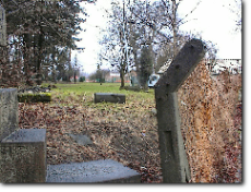
Ironically, restoration from hereon is much simpler. All major road crossings are already bridged, and almost the whole route is clear of buildings. The substantial remains of the next two locks include some marvellous and unique stonework.
Quite how they might be restored is something of an issue which would depend on the Lambourne Drive bridge works before them, and channel works beyond. This is because another short deviation along the edge of some works might be needed to bypass another couple of locks whose sites are occupied by gardens.
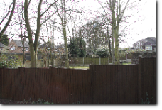
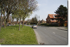
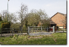
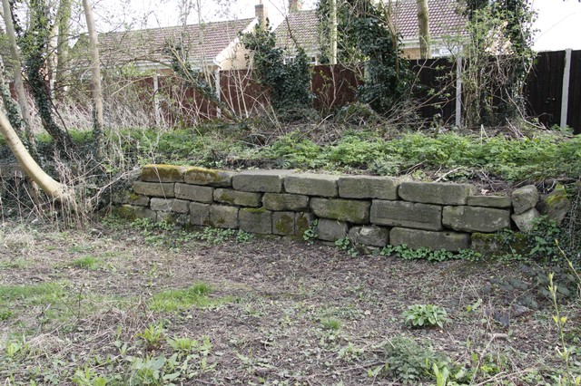
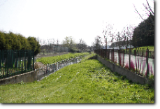
Within the last few years a small group of new houses have been built off Woodyard Lane -
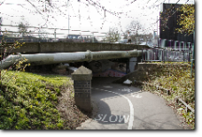
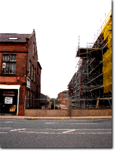
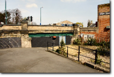
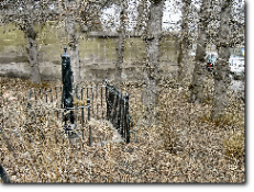
The number 'No 6' remains in place on the original wing wall; adjacent to where an existing bridge carries the canal route under the Nottingham Ring Road. This has survived because it is used heavily as a pedestrian subway and cycle route -
The next section spent many years underneath the Raleigh bicycle factory -

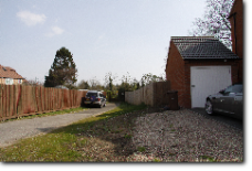
However, there is still plenty of room here to reconstruct a proper width canal on a route close to the original and reconstruct lock five near its original site. A short piece of semi-
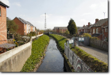
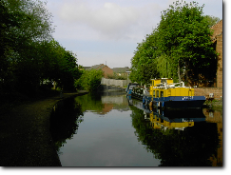
The bridge under the main A52 Derby Road out of Nottingham also still exists. Its current usage is unknown but there is a locked door at the southern end. Just beyond this, a nursery play area, and small car park, have unfortunately been built over the canal line and on a culvert over the River Leen. These would need to be rebuilt over a new culvert for joint use of the restored canal and river. From this point onwards, the canal and the River Leen originally joined forces for the last half mile to Lenton Chain -
Ahead of us now should be the junction with the navigable route through Nottingham - but it is frustratingly hidden by high banks and steel piling. What happened is that, in the 1970s, the water authority completed a flood prevention scheme which resulted in the River Leen disappearing under the remaining canal and thence being diverted along a new channel to the Trent. The website The Lenton Times has a number of pictures of this work along with many other interesting photographs of the canal. Logistically, this inverted siphon is a significant problem for restoration - but is by no means insuperable - given modern technology with automatic gates and controls. Several solutions come to mind, it just requires enough will on the part of those who hold the political cards. This would probably mean the building of a new lock 3 a little downstream of the nursery - or maybe lock down into the Leen from the present siphonic culvert?
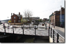
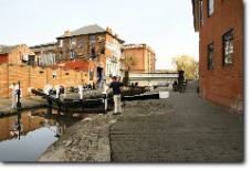
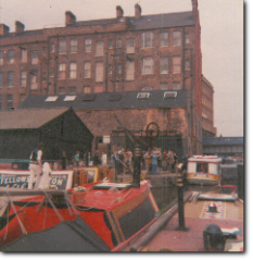
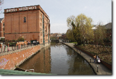
So, to complete our journey from Langley Mill, the navigable section passes the busy Trevethick’s Boatyard and graving dock. More information on this dock can also be found in The Lenton Times. Shortly we pass the packed Castle Marina and reach lock 2 - Castle Lock. Beyond here a redeveloped area includes night clubs, pubs and the courts of justice - an interesting mixture! A little further on, the canal makes an abrupt right-angle turn a what used to be the junction with the Poplar Arm. Along this, two further arms met; the Brewery Cut - which doubled back underneath where the TV studios now stand; and the Manvers Arm - whose reach toward Sneinton was curtailed by the building of the railway.

Two further short arms left the main line along this stretch; the Eastcroft Basin arm and the Westcroft Canal.
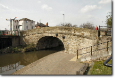
Finally, the end of the last straight turns through ‘bridge 1' to ‘lock 1' and joins the Trent below a new bridge for a ‘multi-
Nothing lasts for ever but we have seen over the last sixty years how derelict canals have a habit of resurfacing after outlasting buildings and other works that were built on them following closure. There is no rush for completion, but what needs to be done now is to take better care of what remains of the Nottingham Canal. We should use more fully what is still available until the rest too may resurface eventually as the opportunities arise.
************************************
All photographs by C & J Deuchar