Nottingham Canal

Go to content

Main menu

Part 2

Awsworth to Balloon Woods

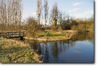
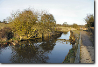
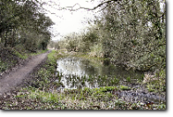
From the Shilo Way culvert, just inside the "11 miles from the Trent" milepost and 3½  from Langley Mill, is a very attractive length of canal.

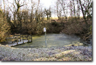
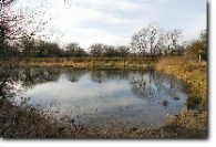
There is a winding hole and small basin - which was once the site of a boatyard. The footbridge across the narrows here marks the location of the former Babbington Branch of the Midland Railway.

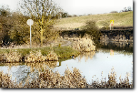
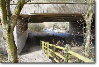
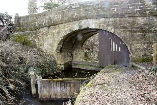
Almost immediately, the canal then passes over significant former aqueduct which has now been reduced to two large pipes.

Restoration would probably see a new steel trough fitted to the same concrete abutments and ought to be a relatively straight forward job.

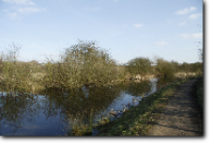
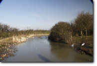
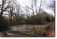
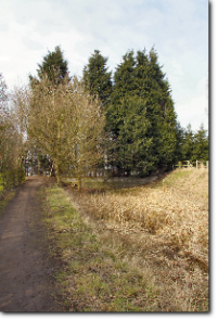
The next few miles would make the effort worthwhile because the canal, fully in water again, now passes through a short cutting before passing by the village of Cossall. This featured in a number of D H Lawrences stories and remains a very attractive place. A couple of footbridges provide minimal problems for restoration as the canal winds towards Trowell. This section is promoted by the council as a ‘local nature reserve’ and a couple of car parks and simple bridge crossings provide access to the towing path.

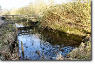
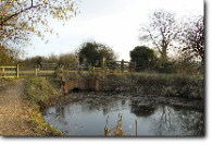
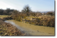
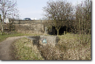
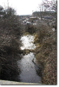
Another branch, the Robinetts Cut, leaves the main line near Cossall but progress along that route is almost immediately stopped by another culverted former swing bridge. It is however a very pleasant walk. The overflow weir along here is quite new and shows someone cares enough to keep it in water. It would be an excellent site for some off-line moorings if the entrance bridge could be rebuilt in some way compatible with modern traffic.

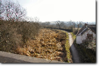
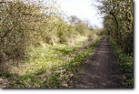
From this junction, the canal continues in water for a good way until, shortly after the second car park, the canal has been infilled again for about ¾ mile - all the way to Trowell Bridge. I remember seeing some of this work done; with the infill being a mixture of waste material and limestone. The reason suggested at the time was that it was to alleviate problems with some of the houses at Trowell suffering leaks running into their gardens. This seemed a rather dubious solution to a problem that ought to have been solved relatively cheaply by piling or putting new clay behind the towpath wall and I suspected that this was merely an excuse to treat the length as a tip. Anyway, the result is that there is still a canal bed to be excavated. It s notable that former winding holes and quarry basins have been left in water as natural ‘features’. Just before Trowell bridge, a short length has had its width reduced to barely the 14 feet needed for a wideboat, as a housing development has spread onto the canal margin. The field on the offside rises steeply above the canal but could theoretically be used to re-widen it, if taking back the ‘stolen’ width was considered inappropriate!

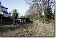
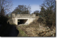
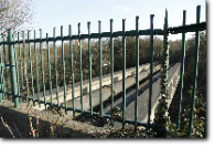
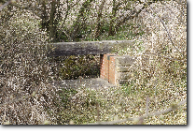
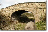
Trowell Bridge itself is a substantial concrete structure which has obviously been strengthened by reducing its original inner dimensions. Even so, I think there is still a large enough aperture for the original navigation dimensions to be reconstructed.  Beyond here, the canal bed is empty - just water is needed - as far as the M1 motorway. Culverted motorway crossings are usually the death knell of canal restoration. However, as I said before, the Nottingham Canal has other solutions. In this case the motorway crossing is not only high enough to pass over the waterway unobstructed, but the bridge over the main road alongside has ample width to allow a restored canal through too. This would be similar to, but easier than, an equivalent restoration done on the Rochdale Canal. This particular bridge was built so extraordinarily wide because at one time a new road was destined to meet the M1 here - but which was eventually built as the A42 several miles to the south.


From the M1, the canal bed is again empty - except for sapling growth - until more water appears, along with another large winding hole and an original stone bridge. This is in excellent condition and carries a bridleway across the canal. It also holds a pair of stop gates.

Immediately beyond this bridge, however, is a garden centre. This began life in an old canalside stone quarry but has migrated from the quarry right onto the canal line. This is a shame, because immediately beyond the garden centre the empty canal bed resumes. Of course the garden centre might like the idea of a rebuilt canal through their premises - but, in the absence of that, then there would be the option of a new section of canal bypassing it round this small hill.


For another mile or so the empty canal bed, occasionally with some water, winds towards Nottingham. It passes under another original stone bridge and arrives near the city boundary at Coventry Lane - where there is sufficient headroom for a replacement bridge but major road works would again be needed. This could be the end of a rewarding length of canal restoration - and would be a worthwhile objective even if it progressed no further. There is ample land for the creation of a basin, moorings and so on. To have got this far from Langley Mill would have created 8 miles of canal (and a number of jobs) with relatively little disruption to adjacent land. Notwithstanding a possible new side lock at Anchor Bridge, it would also be lock free and the length would not only be ideal for a fishery but could also serve water transfer and irrigation needs alongside the usual waterway amenities. Even just rewatered throughout, it would be an excellent small boat and multi-user amenity route.

 
Back to content | Back to main menu